
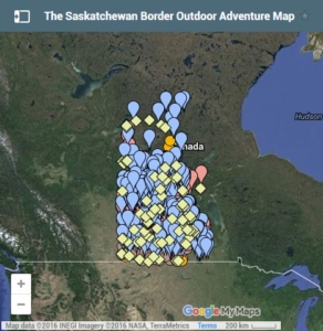
Andy Goodson spent more than a year compiling the massive map
Originally Published by CBC News, April 21, 2016
By David Shield, CBC News
For more than a year, Saskatchewan travel blogger Andy Goodson has poured over satellite images and government maps to create a comprehensive list of every campsite, hiking trail and fishing spot in the province.
“There’s an insane amount of data in that map,” said Goodson. “It’s years of research and painstaking work to make it, to be honest.”
Goodson and a group of friends run a blog detailing their adventures in Saskatchewan’s back country, writing about their discoveries and experiences.
To view the map, click here.
To view entire story, visit CBC News.
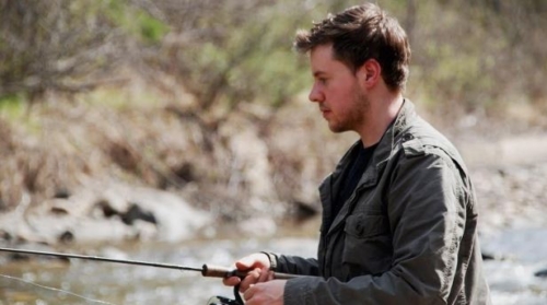
Photo submitted by Andy Goodson.
![]()
Security While Fishing
*** If utilizing a boat to fish, wear your life jacket and ensure that your passengers wear their own, too!
*** Use extreme caution when baiting and getting rid of hooks
*** Do not really fish on unauthorized streams
*** If operating the houseboat, be careful of carbon monoxide build-up round the boat
*** Obey the submitted speedlimits and wake warnings if utilizing a watercraft when fishing
*** Bring along extra safety items for example water, flashlights, maps, along with a cellphone or radio.